Hanging With Ward–May, 2023–Days 1 and 2

In May of 2023 I was the support person for a kayaking trip down the Escalante River by Kerry Ward and Nate “Big Nate” Brouwer. Wednesday, 5/10, started with a drive up to Encino to assist Kerry with one of his Full Tilt Team Development jobs. I arrived at a park where the event was to be held at 11:40 am, met Kerry, and we started to set up the event. It was a fun outdoor event that included a rocket launch and culminated in a bike build where the bikes are donated to a local charity.

We finished up the event by about 4 pm and then made the drive up to the Morgan Castle which serves as one of Kerry’s homes away from home. We stashed the gear from the event, loaded Kerry’s expedition gear into my Prius, and made a nightmarish rush hour drive across the 210 to Arcadia where we picked up Big Nate. The next stop would be Las Vegas where we would pick up inflatable kayaks for the expedition.

On the way we stopped for nourishment at a Taco Bell where Kerry and Nate picked up some crucial expedition food. The plan was for them to drop into the river on Thursday where Utah 12 crosses it just east of the town of Escalante, kayak and camp down the river for four days, and then hike out Monday to a rendezvous point off the Hole In The Rock road. They had, of course, packed some food, but the piece de resistance was the Cheesy Bean and Rice Burrito from the Taco Bell Value menu. They are super cheap (currently only $1.19), filling, nutritious, and travel well when stuffed into a pack. I think they each bought about a dozen.
The American Ninja Warrior set in Las Vegas

Shortly before midnight we rolled into Vegas and made our way to the location where a very large empty lot had been transformed into the set for the American Ninja Warrior competition. Our friend Kyle Deschamps has been involved with that competition since the very beginning and got us access to the set where the final rounds for two seasons were being filmed. We got to watch several of the competition runs, hung out for a while with the very wild and crazy crew that runs the event, and then crashed for the rest of the night at Kyle’s lodgings near the set.

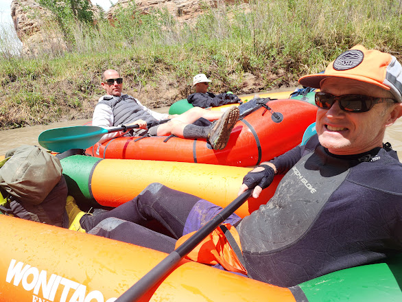
In the morning we rendezvoused with Kerry Sherman at the hotel where he was staying. Kerry S. was in town for a conference and had gone to REI the day before to pick up the inflatable kayaks that Kerry W. and Nate would be using. Kerry S. has been an invaluable friend and resource for many expeditions past and future! The inflatable kayaks were rather bulky. Once loaded there was barely enough room for Big Nate in the back seat.

At the Escalante Visitor Center

Luckily for Nate it was only a 300 mile drive to Escalante, and we pulled into the Visitor Center for the Escalante Grand Staircase National Monument just before 1 pm. The river traverses that monument and the trip would take them also into the Glen Canyon National Recreation Area. After a brief stop to check on current conditions and get the necessary permits we were off to the put in location where Utah 12 crosses the river 15 miles east of town.

Gear Inventory

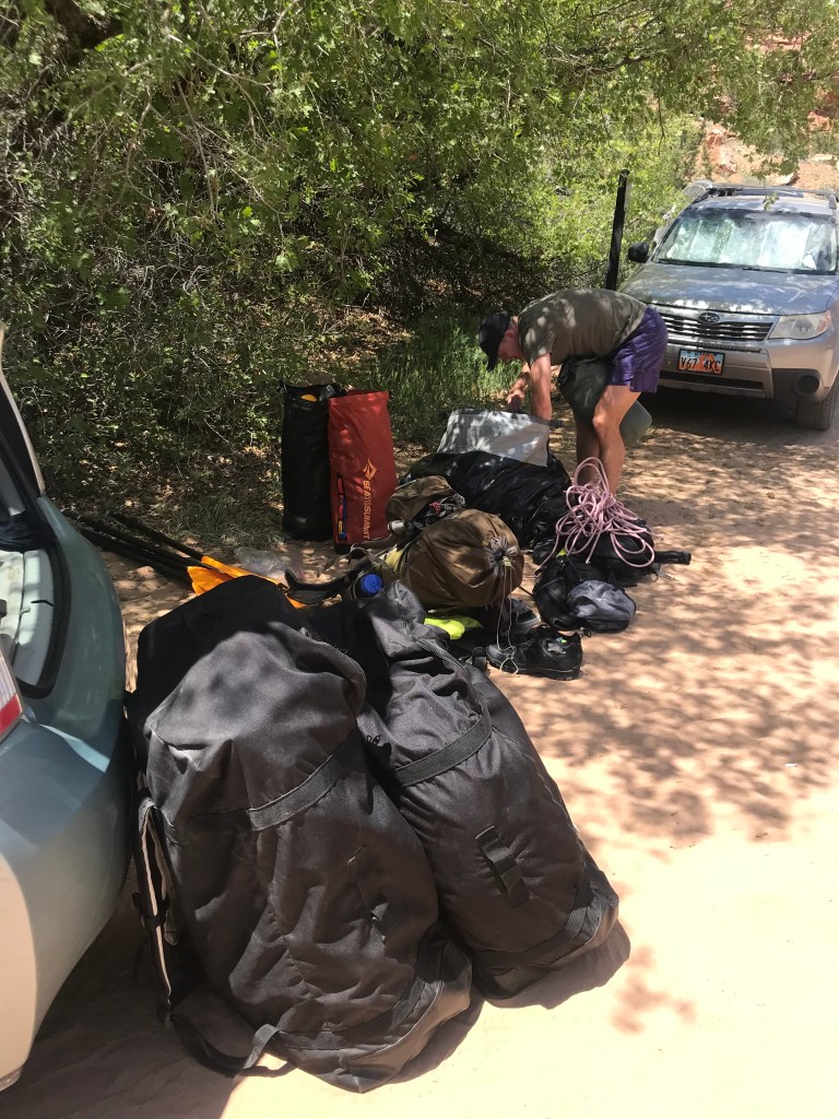
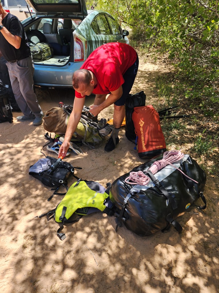
By 1:30 pm we were at the river, had unloaded the gear, and Kerry and Nate were working on organizing it. Since we were at the drop in point already they would only have to carry everything about a quarter mile to the water, but on the extract they would be making a 2.5 mile hike with 1000 feet of elevation gain. That looked like it might be a considerable challenge!

Big Nate loaded down

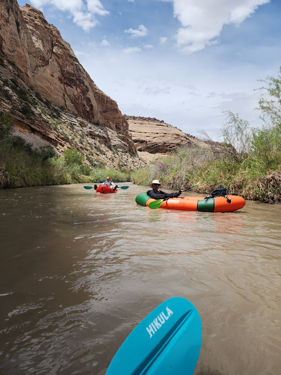
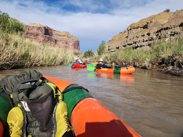
Then it was down to the rivers edge where the kayaks were inflated and loaded with the gear. At 2:18 pm they were in the river and making their way downstream!

And they are off!!

Within the first five minutes they had already encountered their first whitewater. Minimal to be sure, but indicative of the kinds of obstacles they would be encountering along the way.

Running the rapids!

As they made their way down the river they were honing their kayaking skills. Within the first hour Nate was showing some promise!

When coming around corners they often had to negotiate passage past obstacles like piles of brush or fallen trees.

Coming around the corner

Steering can be a challenge. Not sure if Nate’s rotation in the slide show below was intentional or not!

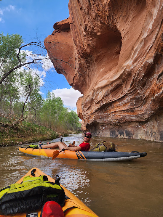
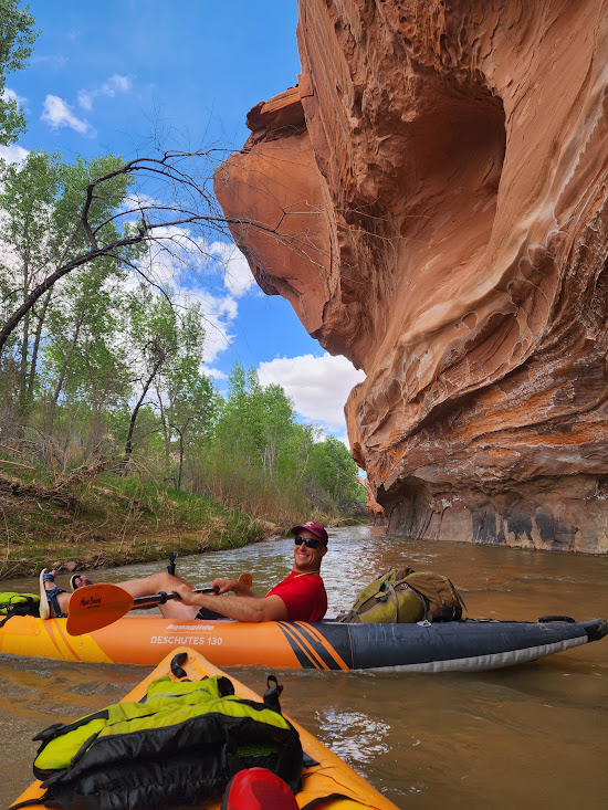
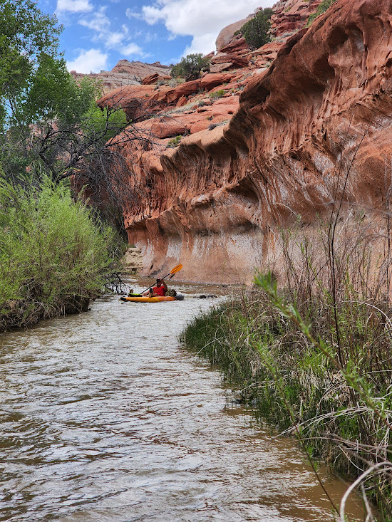
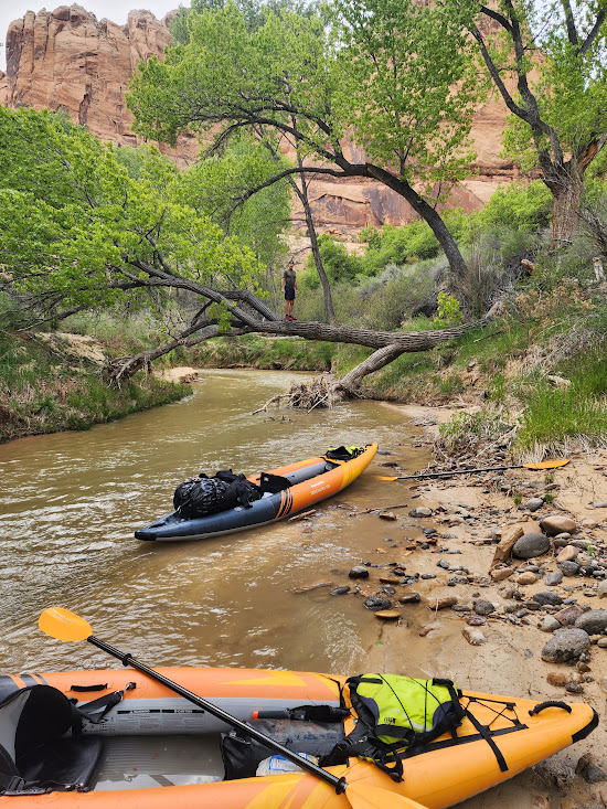
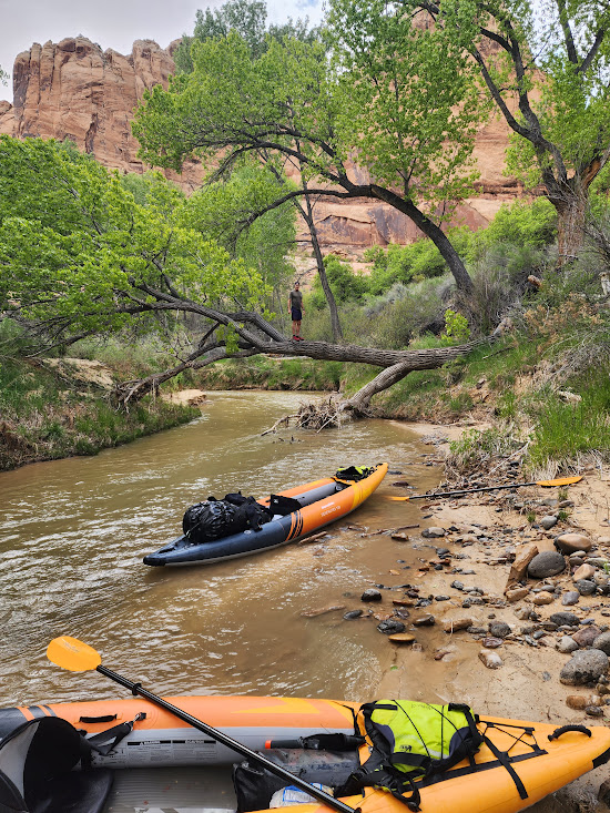
In the first segment they were not really in a proper canyon as there was only a wall on the right side. There were still places where that wall overhung the river. Below we see Nate passing under the eaves and getting up close and personal with that wall.

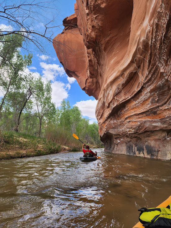
Beware! The river will take you to places you would rather not go. Here Nate successfully negotiates a bit of a tangle with the bank. Poor Nate gets picked on here as Kerry is doing the filming and we don’t get to see Kerry’s misadventures.

Raft Problem Solving

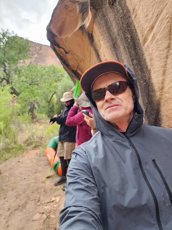
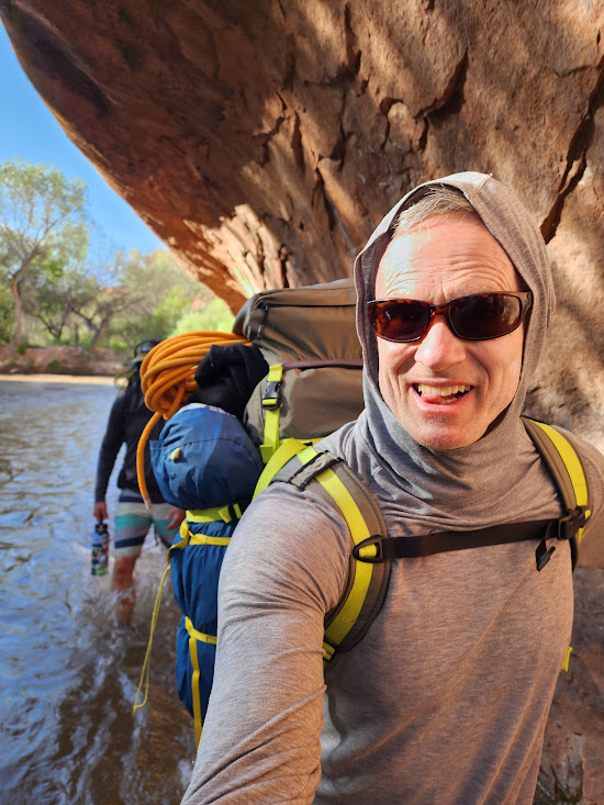
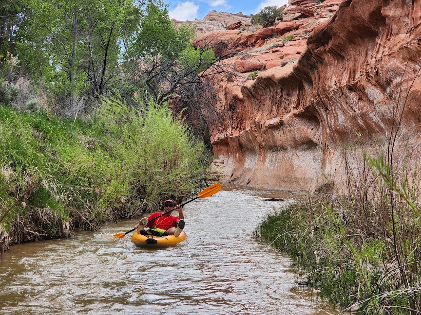
My first travel experience with Kerry was an 11 day trip to Iceland. On the trip I noticed two things: first, if there is a high place, Kerry is on it, and second, he wants documentation. His travel companion is expected to be the photographer. He also has very high standards for his pictures, so Nate got some instruction from the Full Tilt School of Adventure Photography.

In the sequence of shots below the first slide would be unacceptable. Too much wasted space in the bottom of the shot. The kayaks tell a bit of the story, but no need to show both of them. The second slide is only marginally better. The third is a big improvement but fails at the top as the rim of the rock wall behind Kerry is a key feature. The fourth slide pretty much nails it but could be just a wee bit closer. For Kerry it is all about the framing!

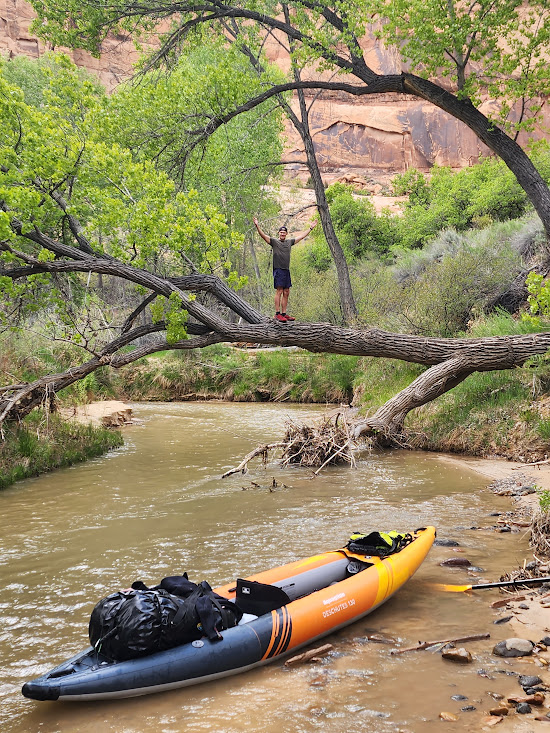
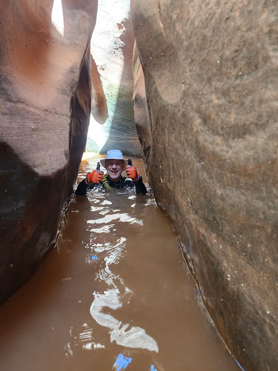
A safety note is in order here. When we went to the Visitor Center this year I remember the ranger talking about the need to wear helmets, and cautioned that rafters had at times bonked their noggins on this overhanging tree. Not so likely when the water is this low and slow, but if the water were higher and rushing through that would be a problem. Given the conditions Kerry and Nate were quite safe, but if they were in a situation where being tossed from the boat in a rocky stream was a likelihood, then helmets would be essential.

In the hurry to get from Vegas to an early put in we hadn’t had time to stop and eat, so after less than two hours on the water their favorite time had arrived! The pause that refreshes!

Burrito O’Clock

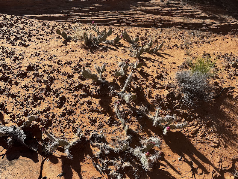
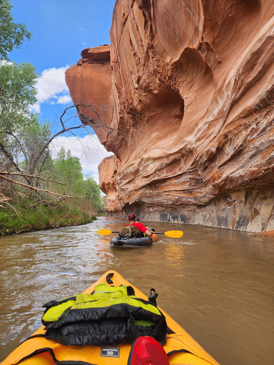
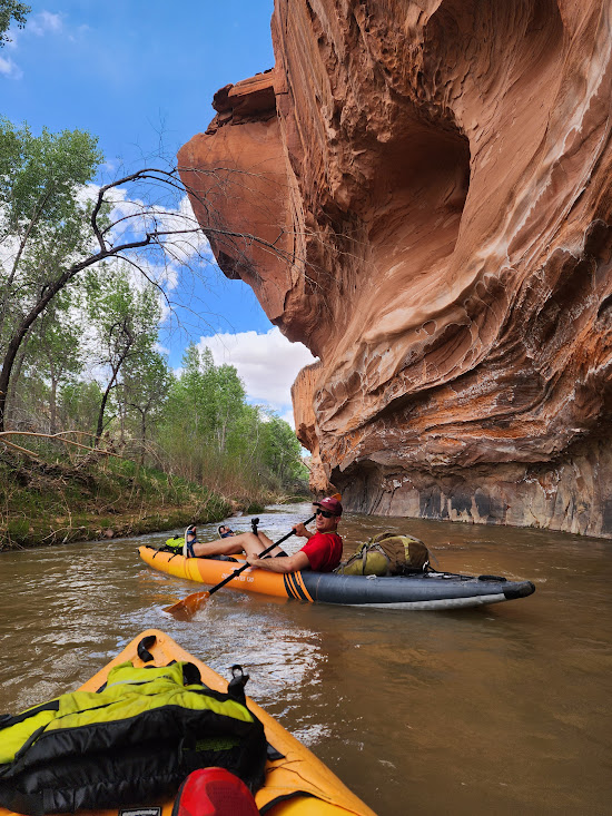
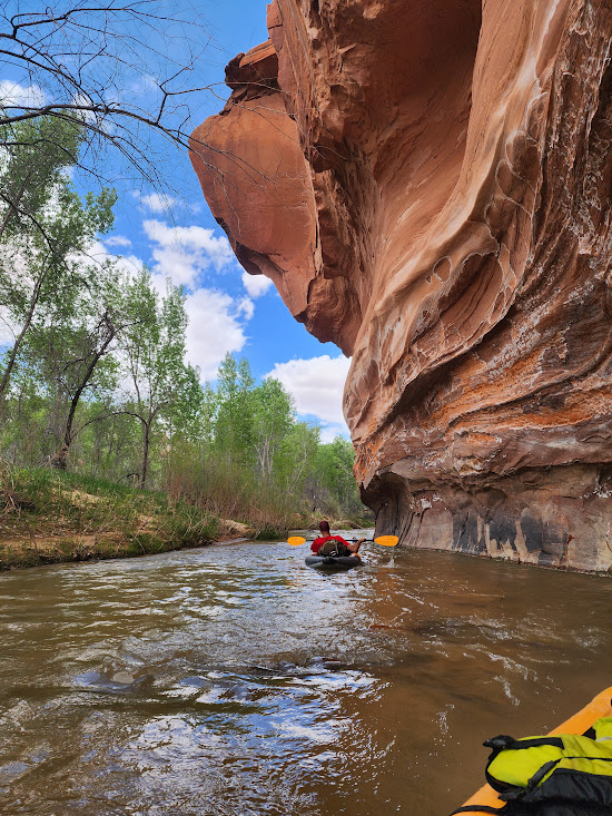
There was no shortage of magnificent vistas as they made their way downstream. Canyonlands are a great place for a photographer!

The view downstream

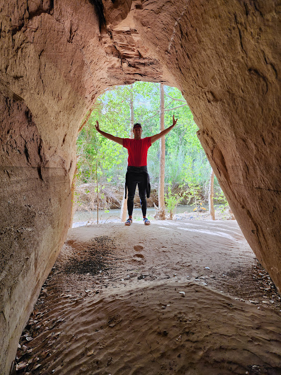
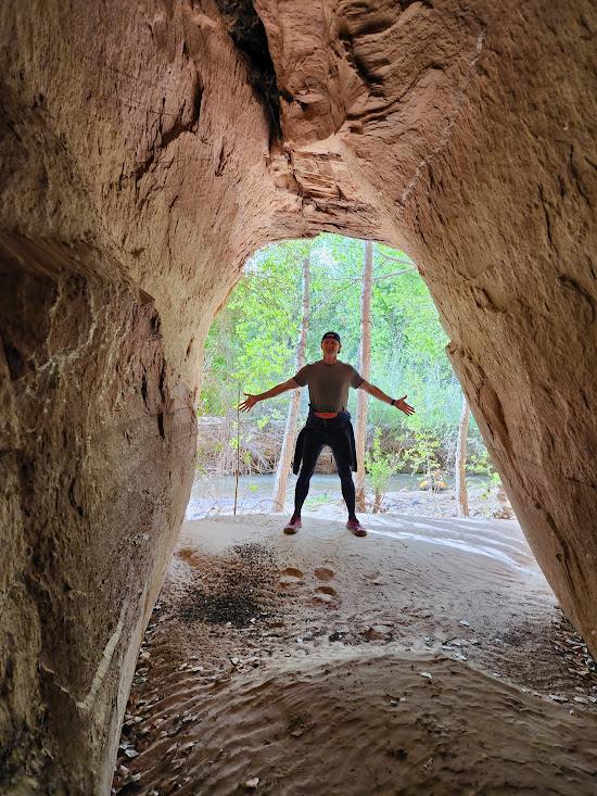
I’ve done a lot of walking around with Kerry, and I am able to keep up with him mainly because he is always stopping to investigate some feature, or pet a cat. At about 5:20 ss they came around a bend he noticed what looks like a cave. So, they beached their boats to explore the cave.

The Cave!!

Even though the cave was a bit disappointing depth-wise, it did provide an opportunity for some classic Ward hijinks. Actually, both of them are inveterate photo hogs, and if there is a proper frame they will use it!

At places where the river widens out, it also gets shallower, so there are going to be many more rocky hazards. In the picture below we can see a bit of a boulder field that they need to negotiate.

There might be a way to float it a through, but sometimes all you can do is get out and walk!

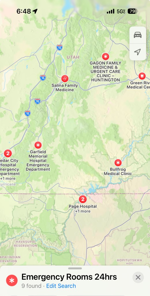
Meanwhile back at the ranch, I was in Escalante after doing some exploring down the Hole In The Rock road. I had made plans to meet up with one of my trail angels. In 2018 I ran the Zion 50K ultra marathon. About 18 miles in I was at the top of a very steep descent that filled me with terror when my feet slipped from under me and I wound up flat on my back. My despair was deepening when I heard a voice asking if I was okay. I looked up and there was a beautiful young lady who turned out to be not just the sweeper but an explorer and writer named Morgan Sjogren. I had a chance to chat with her as she shepherded me through the next eight miles of the race.

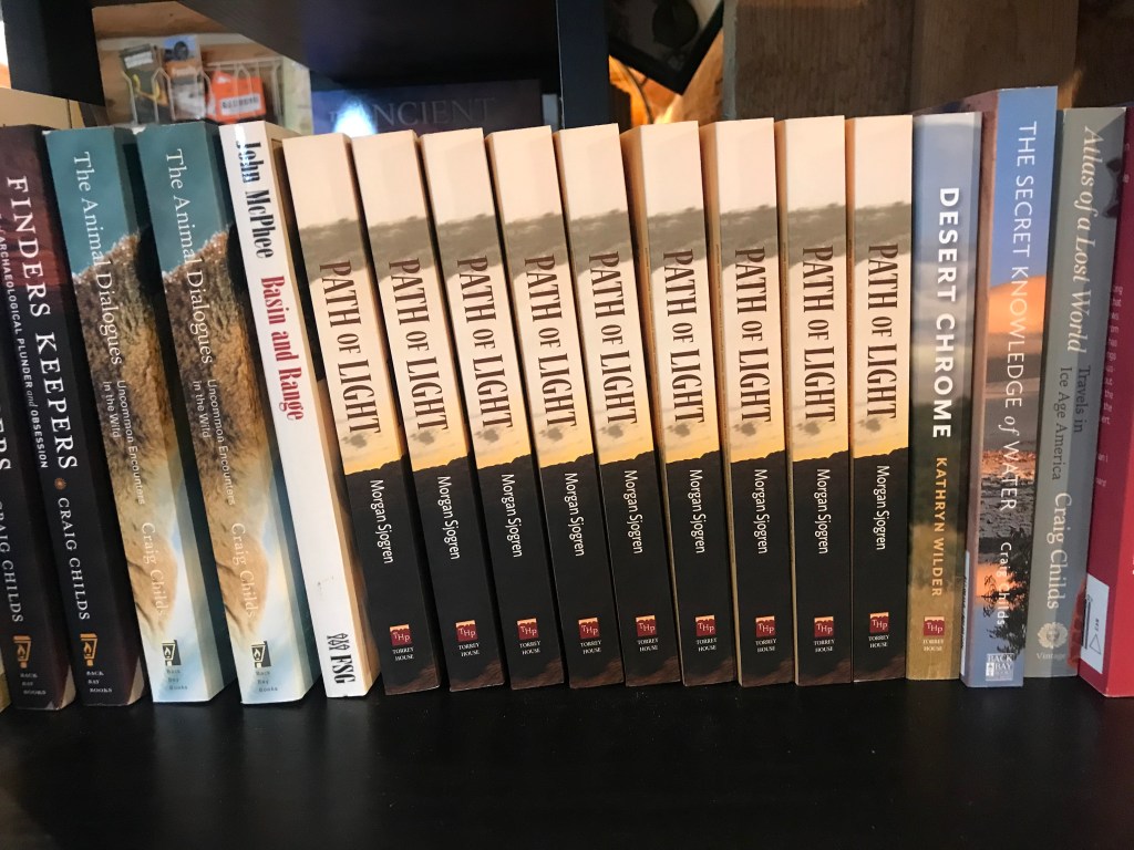
Morgan spends most of her time exploring the desert in the Grand Staircase/Glen Canyon area ala one of her heroes, Edward Abbey. She had planned to be in Escalante at this time, but had made a rare visit to the big city, gotten sick, and was stuck recovering in Salt Lake City. Although our planned meetup did not happen, I was happy to see that “Path of Light”, her new book, was prominently displayed at Escalante Outfitters.

Can you say “slot” canyon?

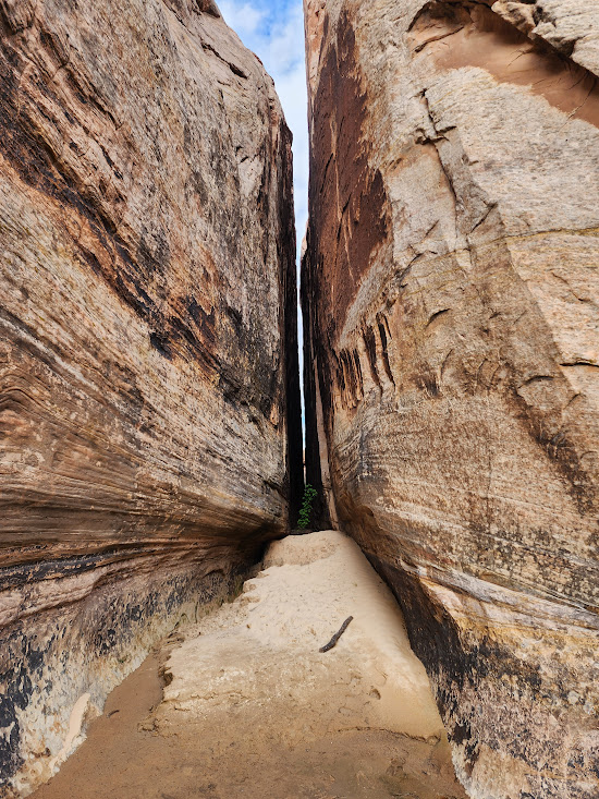
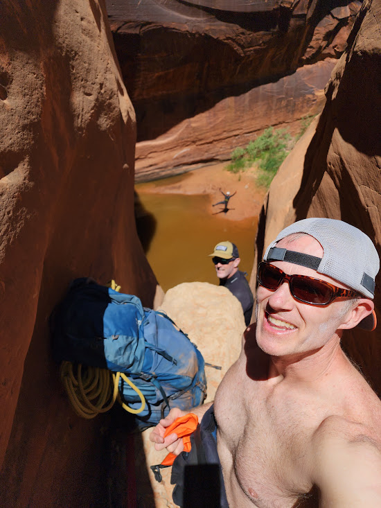
Down on the river, shortly after 6 pm Kerry and Nate had spotted a very narrow crack that appeared to go all the way through the wall. This very tiny slot canyon was definitely worthy of further exploration so they beached their boats and checked it out.

Found something very cool!

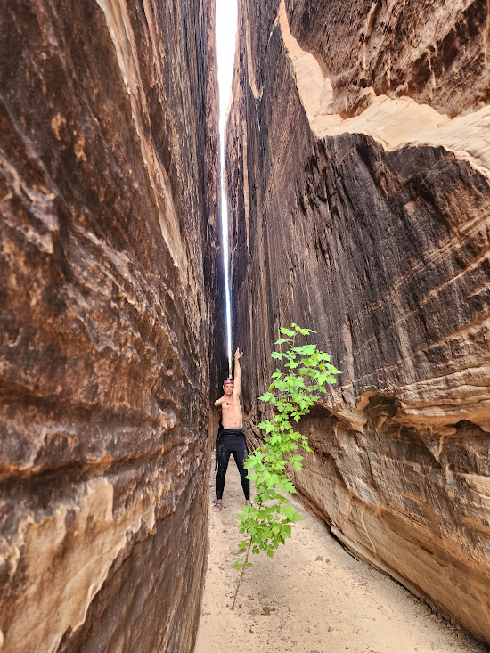
One of the cool things about descending rivers in the canyon lands is that you will encounter many side canyons that are also worthy of exploration. Kerry and Nate did some very in depth (but definitely not very “in width”) investigation. Nate took the lead into the canyon, but soon reached his limit and tagged up.

Big Nate tags up

In Nate’s defense, he is known as Big Nate for a reason, and at 6’5″ or so takes up a bit more volume than Kerry does. He does, however, gamely follow as Kerry takes the lead.

Nate follows Kerry’s lead!

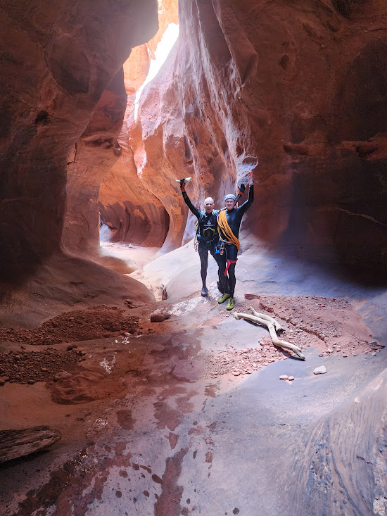
Then came a dream come true, a Shangri-La moment as they burst through the crack to a parallel canyon, a very different world from the one they just left! I am trying to pin down the location, but it appears to be a horseshoe bend kind of a situation where the river doubles back on itself. If so, then this slot would provide a shortcut across the neck for ultra runners traveling the river. Small ultra runners, traveling light!

Shangri-La!!

Of course, such a fine feature is worthy of some of the usual shenanigans!

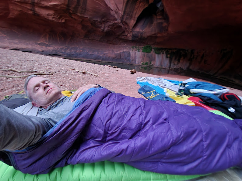
It was time to set in for the night, so they began to look for a campsite. About 30 minutes down the river, or 9.3 miles from their start, they identified a great spot and settled in for the night.

As for me, after dinner at Escalante Outfitters I had headed down Hole-In-The-Rock road to see if it was as awful as it had been described by the ranger at the Visitor Center. It was. Serious washboard for a long, long, way! I made it down about 18 miles, identified a place where I could camp, and settled myself in for the night. I had brought along a tent, but opted just to sleep in my car, which worked out okay.

Hanging With Ward–May, 2024–The Longest Day

Friday, 5/24, or day five of this edition of Hanging With Ward, turned out to be a long day. So long that it actually spliced into the next for a long stretch of sleep deprivation. That is not an unusual feature of an adventure with Kerry, as detailed in my Sleep? Who needs sleep? blog post from the August, 2018 edition!

Luckily, I was quite rested up going into the day, having had the benefit of sleeping in beds at reasonable hours for the trip so far. There were some short nights, but I seem to be able to get by without extended periods of sleep. Six hours is a long night for me, and getting up early has never been an issue.

My original plan was to camp out for four nights as I had in May, 2023 when I supported Kerry Ward and Big Nate for their float down the Escalante.

However, just before 7 pm I got a message from Kerry about a change in plans. They were going to do ChopRock the next morning, hike out in the pm, and then I would pick them up and we would make the 4+ hour drive up to the San Rafael river to join Kerry Sherman and friends for a two day float down that river. I knew then that Friday was going to be a long day with a lot of driving at the end, so I opted for comfort instead of camping and spent Thursday night in a very cute lodging in Escalante, Dora’s Country Cottage.

I did spend a restless night, but that is the norm for me when traveling. I was up early and spent a good part of the morning hanging out at Escalante Outfitters. I had my large cappucino, did some reading and planning, and had a delicious Escalante BLT sandwich. I even treated myself to a piece of cheesecake! For long periods of time I was the only customer.

Friday afternoon I took a drive into the mountains north of town, gaining several thousand feet of elevation in just a few miles and traveling through several biomes until I got up into the tall trees. Due north of Escalante one quickly enters the eastern portion of the Dixie National Forest, and there are countless opportunities for dispersed camping that I hope to explore at some point.

Dixie National Forest north of Escalante

I still had some time to kill, so headed back to town and found a shady spot next to the Escalante River. The bulk of the flow in the lower Escalante comes from the snow melt from Boulder Mountain, but that input comes in downstream from the town, so, except for extreme rain events the flow through town is sparse to non-existent. I spent my time reading, finishing up “Light Perpetual: A Novel”, by Francis Spufford, an author whose work I have been really enjoying. A bit later I was visited by some of the wildlife!

The Escalante River in town

At 6:24 I received a message from Kerry that the Three Amigos (Kerry, Chris Hardwick, and Max Simmons) had reached the mouth of Fence Canyon and would pump water, repack, and start back to the trailhead. ETA 9-9:15. I drove out to the trailhead a bit early to cut down on the night driving.

The view from the Egypt 1 trailhead

There was a small group camped at the trailhead. They were going to be doing a multi-day trip much like the one the Amigos had done. They planned to take four days to do what the Amigos did in two. They were eagerly awaiting the return of the Three Amigos as they wanted to get intel about the canyons in question.

About 9:30 Kerry arrived at the trailhead and had a chat with the group camped there. Chris and Max arrived shortly after, and I was apprised of a development that was going to make an already long day even longer. Max had gotten his hand caught between a rope and a hard place and had sustained some substantial damage. It had bled substantially and he was in some pain. They had no first aid gear along, so he had just put on a glove that had managed to stanch the bleeding, and he wanted to have it examined by a doctor.

That was more than a bit of a problem. It was 10 pm on a Friday night, and we were in nowhere, Utah, 27 miles from the nearest paved road with no cell phone service. We loaded the gear into my car and I made the drive up Hole-in-the-Rock road until we got the Utah 12 where we could get some cell service. A search for 24 Hour ER’s turned up a number of options, with the closest one being 66 miles away in Panguitch.

I hit the road and just before midnight we pulled up at the Emergency Room entrance at Garfield Memorial Hospital. Within seconds of our arrival an orderly appeared asking if we needed a wheelchair, and that was just the beginning of some top flight emergency medical care. Max walked in, found that he was the only patient, and was attended to by what seemed to be about 4 or 5 lovely nurses. I was a bit envious! While we sat in the waiting room a nurse came by and gave us cans of coconut water to tide us over. I can’t say enough nice things about the service we received at this hospital!

They cut the glove from Max’s hand, cleaned it up, took x-rays, and determined that nothing was broken and he didn’t even need stitches. We were free to go. The lads were pretty drained from their adventures over the past two days, and we were due to meet up with friends Sam and Audrey in the morning at the Swinging Bridge over the San Rafael river. That was 188 miles and over three hours away. A search for some lodging proved fruitless, so it was back to the road again.

The first phase of the trip was a 60 mile drive up US-89. Route 89 is a pretty awesome road that runs from the Mexican border up through Arizona, Utah, Idaho, and Montana to the Canadian border. I have driven quite a few miles on that road and have ambitions of driving the entire route, but I prefer to do it in that daytime! The ride was going smoothly, but as we approached Interstate 70 it began to rain.

By the time we got on the interstate the sprinkling had turned into a downpour. That segment of I-70 has pretty indistinct lane markings under the best of conditions, and under a heavy rainfall it was very difficult to see them, so the next 40+ miles were pretty nightmarish. I finally reached the point where I was at my limit and found a pull out where we could stop and I could close my eyes for 30 minutes. By that time the rain had stopped and the rest of the drive passed without incident.

At the Swinging Bridge trailhead

Just before 5 am we arrived at the Swinging Bridge trailhead on the San Rafael River. Sam and Audrey had driven in the day before and had already headed down the river. Sam had left his truck at the trailhead with the keys in the exhaust, so Chris and Max moved over to the truck and the four of us settled in to try to get a couple of hours of sleep before hitting the river.

By about 8:30 we were up and moving around and trying to decide what to do next. Kerry Sherman had put in the day before about 20 miles upstream with a couple of friends. They were planning on a two day float terminating about 20 miles downstream, but we didn’t know how far they had gotten or if they were up or down stream from us. Sam and Audrey had put in at the Swinging Bridge about 7 pm the day before and were some unknown distance downstream. Water in the river was flowing quite nicely at just over 300 cfs.

Water under the bridge

The segment above the Swinging Bridge passes through what is known as the Little Grand Canyon and is a serene flat water float that is very scenic. There are numerous opportunities to stop and explore side canyons rife with pictograms and petroglyphs. Below the Swinging Bridge the river has two segments, known as Black Boxes 1 and 2, where the canyon narrows and there are some extensive rapids ranging from Class II to Class IV.

About 9 we received a message from Sam that they had gotten downstream a few miles to just before the first Black Box where they had camped for the night. Sam had planned on running the two BB’s, but Audrey very sensibly had balked at rapids running without safety gear like life vests and helmets. They had come out of the river and were hitch hiking back to the Swinging Bridge with the plan to drive back up the river to Fuller Landing where they could put in and float the Little Grand Canyon. We resolved to do the same.

We did have a bit of a problem, however. My gas gauge said we had about 60 miles left, and the nearest gas station was in Green River, about 50 miles from where we were. My gas gauge tends to badly underestimate remaining miles, but trying to make the 20 mile drive to the new put in location and then get safely back to gas was not a prudent option, so our first task was to climb back in the car and make the drive to Green River to fuel up. The advantage was that we did get to see the stretch of road between the river and Green River in the daytime, and I got a chance to get some coffee.

By 10:30 am we finally were back on the road. We crossed the river at the Swinging Bridge, and the next 10 or so miles took us through some pretty fantastic canyon lands in an area known as the San Rafael Swell. There were interesting rock formations and pictograms galore along the road.

Just before noon we reached the put in location at a location called Fuller Landing. We found Sam and Audrey as well as several other groups who were also entering the river at that point. There was even a drop in dog for our entertainment!

Drop in location at Fuller Landing, complete with dog!

The lads then finally got to unpack their pack rafts, something that they had been looking forward to for a long time! The previous May I had supported Kerry Ward and Big Nate on a four day float down the Escalante. They had rented inflatable kayaks from REI for that trip, and the kayaks themselves were quite a load to carry. The video below shows Nate with his load, and for reference know that Nate is about 6’5″ tall. They were lucky there in that they got to drop straight into the river, but the exit four days later required a 2.5 mile hike with 1000 feet of elevation gain. Not easy with such a load!!

Big Nate with gear for a four day float down the Escalante River

For this excursion they were using Pack Rafts, a kind of mini kayak more suitable to the kind of flat water rafting they were planning on doing. Sam and Audrey were using some more deluxe rafts that cost from 1 to 2 thousand dollars, but Kerry had found some considerably cheaper Chinese versions by Wonitago that are currently available for under $300 from Amazon. They pack down to a very small package that weighs just over 6 lbs!

Unpacking the Wonitago “Enjoy Passion” pack rafts

The Wonitago rafts have an inflation process that doesn’t require a pump, making use of the carrying case as an inflation device. It does work but is more than a bit tedious, so for excursions like this one where it isn’t really necessary to carry the raft it would be advisable to have some kind of a pump.

Chris inflating his pack raft

Just before 1 pm the now Two Amigos (Max had decided to opt out of the rafting so as not to stress his hand anymore), plus Sam and Audrey, were ready to drop in and head down river.

Max had decided to opt out of the pack rafting, so the two of us were free to explore. Max is also a fan of coffee shops, so my plan was to do a scenic excursion. My plan was to first drive down to Hanksville where I had found a very nice little coffee shop named Mowgli’s that I had visited on an earlier excursion, but unfortunately it was closed. Instead we had some Mexican food at the Outlaw’s Roost, a local restaurant.

Hanksville sits in the shadows of the Henry Mountains, which were the last mountain range in the lower 48 states to be surveyed due to their very remote location. After our repast we drove down Utah 95, a very scenic route that starts in Hanksville, skirts the Henry Mountains to the east, and then winds through the canyons north of the Colorado River. The full route crosses the Colorado River at the Hite crossing and then continues through far southeastern corner of Utah until it terminates at US-191 south of Blanding.

Colorado River from the Hite Overlook

We were working under a deadline as we needed to be back at the Swinging Bridge to retrieve Kerry and Chris, so we only got as far as the Hite Overlook. I took some pictures, but the wind was so strong that I feared being swept off the edge. I suffer from some vertigo, so even under the best of conditions I am not one to step right up to the edge, so I am falling back on the video I took when I traversed this route last August.

River at the end

Then it was back in the car for the 120 mile drive back up to the Swinging Bridge. Our timing was perfect–we arrived just as the rest of the crew were extracting their rafts. There had been some thunderstorms in the interim and the river at that time was noticeably higher and faster than it had been in the morning.

All packed up and road ready

It took less than an hour to deflate, repack the rafts, and reload the car. We were ready to head back to Saint George, but Sam knew of a hot spring that was almost on the way back. In addition to cats, Boba Tea, and high places, hot springs are one of those things that Seńor Ward does not pass up, so the next stage was a 2 hour drive to Monroe, UT, a small town south of Richfield for a quick soak in a natural hot tub.

Just before midnight we were back on the road. The drive along I-70, while only about 30 miles, seemed like forever, and by the time we hit I-15 it was apparent to me that my time behind the wheel had come to an end, so I relinquished the wheel to Kerry and closed my eyes. Thus ended a very long day! I will close with a slide show of images taken by Kerry and Chris on their 17 mile float down the San Rafael River. They did see a lot of other folks on this trip, and Kerry even picked up a hitchhiker for a short stint!

Hanging With Ward–May, 2024–ChopRock

When we last left our intrepid adventurers they had successfully descended the technical portion of Neon Canyon and landed in the pool in the Golden Cathedral. Wet gear was hung out to dry. Chris Hardwick slept in his tent, sans rainfly, while Kerry and Max camped cowboy style on the sand. By 6 am there had already been signs of life. Gear had dried and the morning light was flooding the Golden Cathedral.

Golden Cathedral in the Morning

The three amigos, Kerry Ward, Chris Hardwick, and Max Simmons readied themselves for a challenging day. Kerry needs no introduction here, but some attention to his companions is warranted as they both have pretty extensive shared histories with Kerry.

Chris Hardwick is an Australian entrepreneur and adventurer currently living in Vancouver, CA. Chris owns a Land Cruiser named Thor that he keeps in Africa. He and Kerry spent a month last year driving Thor around the southwest of Africa and will be exploring east Africa in Thor this July.

Max Simmons is easily Kerry’s oldest friend. They were born within months of each other in India where their parents were doing work related to public health. Their parents are great friends and the families have maintained close connections over the years, doing things like vacationing together. When Kerry was spending his formative years in East Lansing Max was living in Ann Arbor and would often make the 60 mile trip to Lansing to hang out with Kerry at places like Pinball Pete’s.

Three Amigos–Chris, Kerry, and Max

There is a large rock wall near the Golden Cathedral that has a lot of petroglyphs, or artwork etched into the stone. Some of it was created by indigenous people from time immemorial, but there is also a lot that is of more recent provenance. Think of it like a big, stone bathroom wall.

The objective for the day was going to provide a peak adventure experience for the three amigos. There are certain constants when hanging with Ward. If there is a high place, he is up there; if there is Boba place he wants some; if there is a hot spring, he is in it. He is exceptionally attracted to slot canyons, the more difficult the better. In 2018 I was crew when he, Kerry Sherman, and Sam Edwards descended the very challenging Heaps Canyon, and the target of the day, ChopRock, promised significant problems to untangle.

According to Canyoneering USA, “It is a nice one, one of the best. It can be very difficult, and should always be taken seriously. It is not a place for “Youth Groups”, college outing club adventure hikers, or “experienced outdoorsmen”. It is a place for experienced canyoneers.” There is a certain body of knowledge required to safely descend slot canyons. Proficiency at using climbing harnesses and rigging anchors for rappels is essential. There are places where rushing water has carved out deep potholes (keepers) that may be filled with water, so the canyoneer must know how to deal with them. Narrow spots may be clogged with debris making every descent different from those that came before. Teamwork is essential to make it through, and while the Three Amigos are a pretty small team they rank high on that teamwork index.

Shortly after 8 am they made their way out of Neon Canyon and began wading up the Escalante to the mouth of ChopRock. Near the mouth of the canyon they followed a trail taking them up to the table lands above the canyon. By 9:30 they were well above the canyon and the serious route finding began.

The table lands above and between the canyons alternate between slickrock, or bare rock surfaces, and pockets of sparse soil. In a very lightly traveled region like that leading to a difficult canyon like ChopRock trails are largely nonexistent or very sparsely marked. Kerry is very adept at negotiating such a landscape as I saw first hand when Kerry, Tom and Mari Seletos, and I took a memorable trip to Rainbow Canyon in this area several years ago. You can find Kerry’s video on that trip here.

Cryptobiotic soil with plants

Much of of the area between bare rock supports something called cryptobiotic soil. Our planet is always changing, and bare rock ultimately weathers, erodes, and is transformed into barren soil. That barren soil is then transformed into biologial soil through the actions of cyanobacteria, algae, and fungi. According to the NPS, “Biological soil crusts, sometimes called cryptobiotic soil crusts, are an important part of arid and semi-arid ecosystems throughout the world, including those in Glen Canyon National Recreation Area”. The preservation of those crusts is of paramount importance, so it is important for travelers to stick to established trails and to avoid disturbing these patches.

By about 10:20 they had identified their slot canyon target below them and were looking for a way down to it.

On the table lands and looking below for the target canyon

They picked their way down to the slickrock along the canyon rim looking for an access point where they could make their way down to the bottom of the slot

On the slickrock above the slot and looking for a way down

By about 11:40 they had identified a point where they could scramble down to the bottom of the canyon. It wasn’t long before they came to their first rappel and immersion in water.

In this type of canyon there will be places where you need go go down but can’t even see the bottom. In the video below Max takes a leap of faith while praying that the rope is long enough to get him down safely.

Where did he go??

Max did indeed find the bottom and Chris and and Kerry joined him shortly. Shortly after 1 pm they had another opportunity to rappel down into a lake. In canyoneering even entering into the rappel can be challenging.

The article on ChopRock in the Canyoneering USA broke the canyon down into different sections, and the slideshow below has some sights from the segment that was characterized as the “Happy Section”. According to the article, “The Happy Section alternates long cold swims with nice walking through slots, plus a couple of downclimbs.”

Happiness doesn’t last forever, however, and pretty soon they were into the “Grim Section” with some long swims and very tight squeezes. This is not a canyon for people with large frames!

Canyoneering is not recommended for anyone who suffers from claustrophobia. Also not for the portly among us! Kerry has a very slim build, and even he was squeezed on occasion.

Wetsuits are essential for this type of escapade. Part of the mystique of ChopRock stems from the fact that in May of 2005 a pair of young men attempted the canyon without proper equipment and wound up dying from hypothermia. Depending on water levels there may be many hours of swimming required.

The Three Amigos posted a lot of pictures and videos early in this adventure, but the volume of media dropped off sharply as they traversed the Grim section. It’s kind of hard to get out the camera when one is swimming through a long section trying to keep the gear bag high and dry.

There is a goodly amount of problem solving required to get through some of the tight spaces. There may even be sections where the bottom of the canyon may not be too narrow to afford passage and it is necessary to do things like go over an obstacle.

Problem solving and cooperation are essential
Through the labyrinth

Near the end of the slot portion Max sustained an injury to his hand. On one of those difficult entries to a rappel he got his hand caught between the rope and a rock. If injured there is nothing much one can do besides soldier on. There is no backing out once you have descended into the depths of the canyon. Max did violate one of the precepts of responsible wilderness travel by leaving something behind, but I think the wilderness will recover!

Finally, the end of the slot portion was in sight. It is quite common for these slot canyons to end as hanging canyons requiring a significant rappel that is one of the highlights of a slot canyon descent. The final rappel at ChopRock pales in comparison to the 300 foot exit from Heaps Canyon, but a 90 foot drop is nothing to sneer at.

Last one down
It’s always cool when you can do a spider drop into a pool of water for the finale!

Once down it was an easy walk down the canyon back to the Escalante River. Kerry was able to send me a message just before 6:30 predicting that they would be back at the Egypt trailhead shortly after 9 pm.