
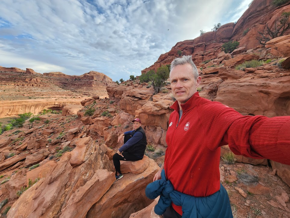
Down on the Escalante River Saturday was a great day for Kerry and Nate. They started the day just after 7 am. Their campsite was just below a rock feature known as ChopRock.
True to form, Kerry set out to get to the highest point he could but soon ran into an obstacle.
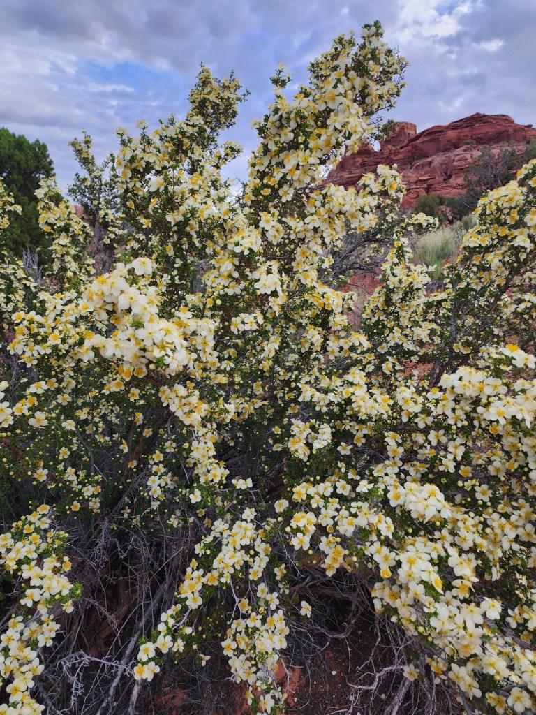
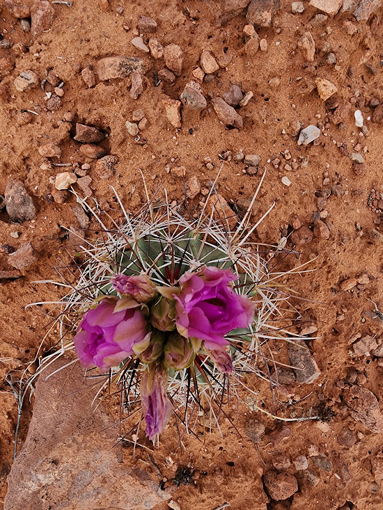
Kerry did the responsible thing, and instead of trampling all of the cryptobiotic soil he decided to save ChopRock for another expedition. Instead he spent some time enjoying the local flora.
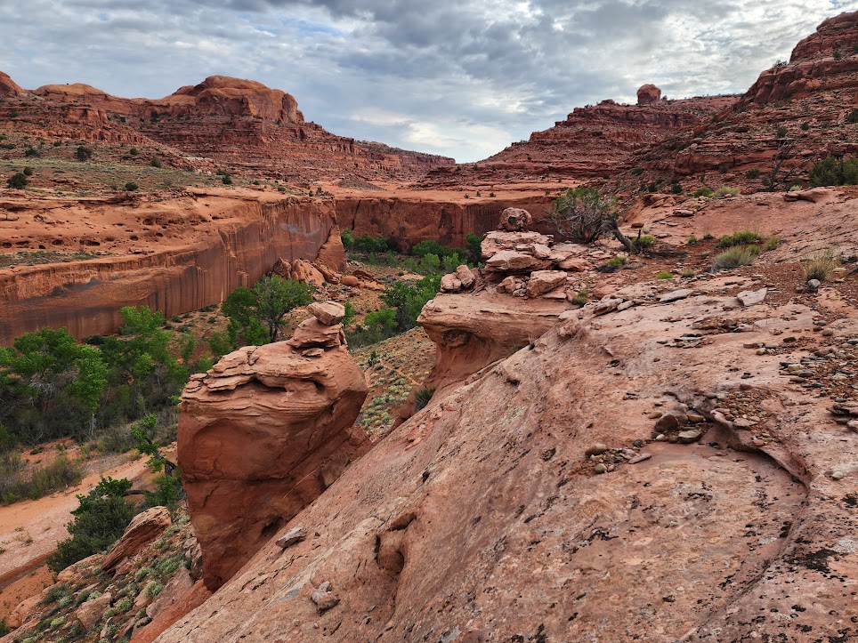
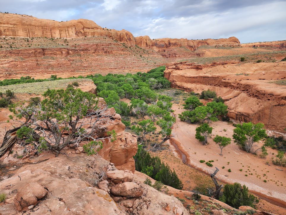
Here is a nice view of the previous night’s campsite from above.
Here is a bit of a slide show from their morning below Chop Rock.


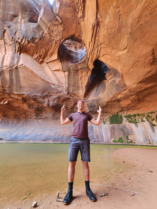
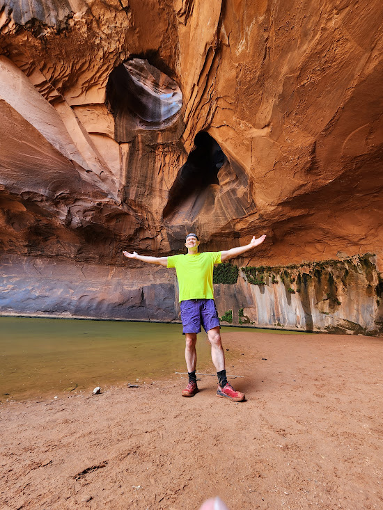
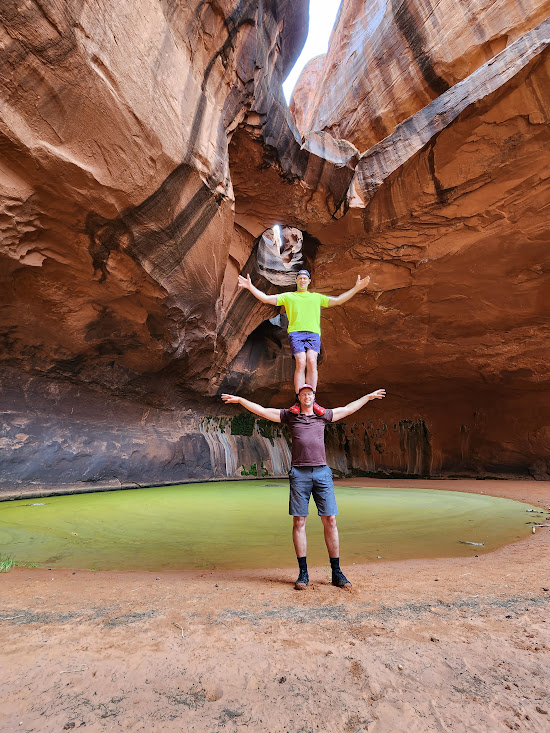
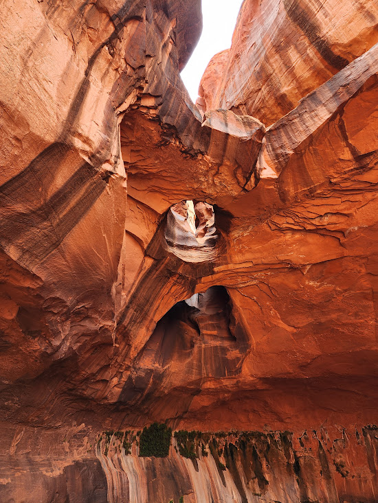
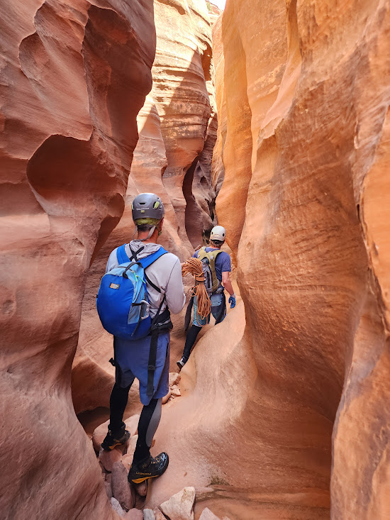
Then it was back to the boats for a few miles of paddling to the mouth of Neon Canyon. Neon Canyon is a very popular destination along the river. It is easily accessible to hikers from a trailhead off the Hole in the Rock road that is only about 30 miles from Escalante. Neon is also home to an amazing feature called the Golden Cathedral that has been on Kerry’s bucket list for a long, long time. They beached the boats and started a mile long walk up canyon to the Golden Cathedral.
At this point Kerry was really wishing that he had the necessary gear to go for the ultimate Golden Cathedral experience. The section of Neon Canyon above the GC is a serious slot canyon, and the E-ticket experience is to climb up to the table land above, descend the slot canyon, and then rappel down through the holes in the ceiling. That requires appropriate ropes and harnesses that they had not brought!

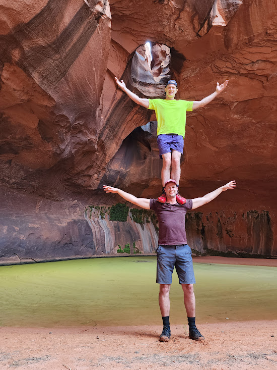
Such a beautiful setting was not to be left without some good shenanigans!!
When they got back to the river their prayers were answered. They met up with a pair of hikers, Brett and Dean, who had the right gear and were planning on making the descent, so they teamed up with them! By 1 pm they were off on the hike up to the Neon slot drop-in point.
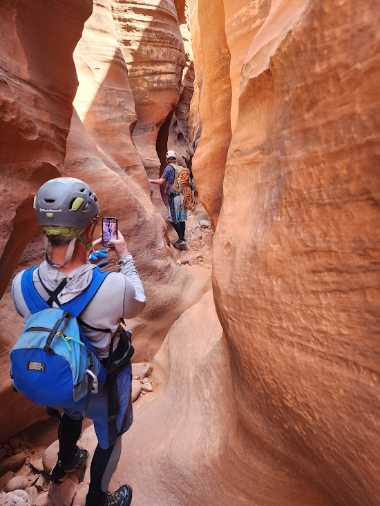
Just before 2 pm they had reached a point where they could descend safely into the slot.
Soon they were in the canyon and applying their canyoneering skills.
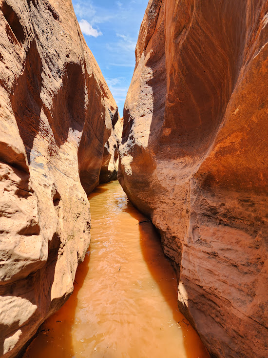
It was soon time for what Kerry refers to as Type 2 fun as they reached their first flooded stretch.
Kerry gets a little crazy here! Probably would have been a good time to be wearing a helmet.
About 3:30 they had reached the point where they could drop through the ceiling of the Golden Cathedral. Time for a gear check.
Kerry was the first one down and made sure he had his camera ready to roll.
The last part of the rappel into the Golden Cathedral is a relatively short free hang section.
Then it was Nate’s turn to descend.
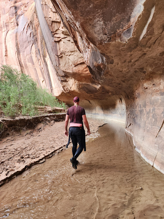
By 4 pm, with another bucket list item checked off, they were back on the river as they only had one more full day and many miles left before they would be leaving the canyon.
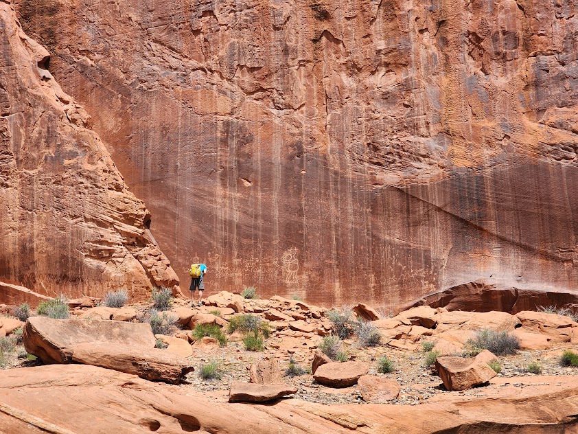
Of course there was still time to explore any side canyons that they encountered!

Here is a slide show from their afternoon.


As for me, I woke early Saturday morning at my campsite along the Fremont River in the FishLake National Forest to a steady rain. I set off back towards Capitol Reef, hoping to find a coffee shop or restaurant to get some breakfast. The pickings were very slim, and it wasn’t until I got all the way back to Torrey before I found an open restaurant. The skies had cleared, and just after 8 am I was able to watch a group of tourists set off on a guided llama tour targeted for families traveling with kids.
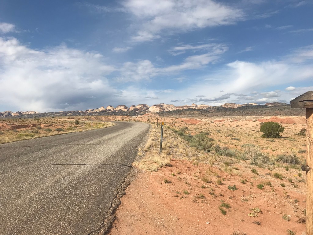
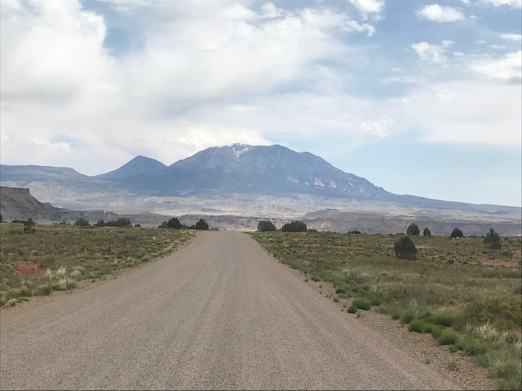
My plan for the day was to do a bunch of driving. In my excursions the previous day I noticed an interesting unpaved road, the Notom-Bullfrog road, that runs about 31 miles from UT-24 along the eastern side of the Waterpocket Fold all the way down to the Bullfrog Marina on Lake Powell. The road runs between the Waterpocket fold on the west and the Henry Mountains on the east and looked like a very nice route!

At about 9:30 I set off down the Notom-Bullfrog road. The first couple of miles were paved, but the rest was dirt. It was mostly smooth, with only a few rough sections. Quite a contrast from the Hole In The Rock road!
The road runs parallel to the Waterpocket Fold and you can see the steep escarpment where the land east of the fold had dropped relative to the west. What we can see is just a hint of a much larger geologic event that happened 50 to 70 million years ago where a major fault caused the east side of the fault to drop around 7,000 feet. That fault was buried deep in the earth, and what we see today is the result of the uplift of the Colorado plateau followed by erosion.
From Wikipedia, “The fold forms a north-to-south barrier that has barely been breached by roads. Early settlers referred to parallel impassable ridges as “reefs”, from which the park gets the second half of its name. The first paved road was constructed through the area in 1962.” In the video above you can clearly see the reef-like nature, and try putting yourself in the place of a settler trying to take a wagon to the other side of a reef that extends 60 miles from high mountains in the north to deep canyons in the south and you can understand why this part of Utah was very sparsely settled.

The Fremont River starts up in the Wasatch Plateau to the west of Capitol Reef just 8.4 miles above where I had camped for the night. Water must keep moving from high ground to low and the Fremont River provides a channel for a flow from the Wasatch Mountains all the way to the Colorado River. The canyon carved out by the Fremont River as it moves from the 10,000+ elevation of the Wasatch Range down to the Colorado River provided relatively easy access across the reef. UT-24 follows the course of that river from Loa all the way until it is joined by Muddy Creek to form the Dirty Devil River just downstream from Hanksville .
The first 20 miles of the Notom road passes through areas that are quite open and sprinkled with the remnants of early ranches and small settlements. At about 20 miles you reach the turnoff for the Cedar Mesa campground, which is probably the only campground in the National Park where there might be space available without advance reservations. It is primitive, very small (five sites), and available on a first come first served basis.
Below Cedar Mesa the road enters a relatively narrow wash, and then in another 13 miles it meets the Burr Trail Road. That road is the only other paved road that cuts across the Capitol Reef. It terminates at UT-12 at Boulder. The BT road leaves the relatively flat wash and cuts east across the canyon lands immediately above Lake Powell. There are spectacular deep canyons and great views of the very depleted Lake Powell. About 4 miles from Bullfrog Marina the Burr Trail merges into UT-276 for the final stretch.

The BF Marina was quite underwhelming due to the extremely low water levels. The Visitor Center was closed and my car was the only one in their parking lot. I made a very brief stop and then started back up. One option from this point would have been to take UT-276 to Hanksville, but I opted to retrace my steps up the the point where the Burr Trail Road cuts across the reef. Some people turn up their noses at out-and-back routes, but I find that, especially in areas that are so scenic, the return looks like completely different trip.

When the BT Road descended back into the wash below the Cedar Mesa Campground and proceeded north I was very conscious of how intimidating what appeared to be a solid wall of cliffs would have been to explorers. When I reached the junction with the Notom Road the Burr Trail Road headed west into a canyon where a set of hair-raising switchbacks starts a five-mile climb to a summit at 6822 feet.

At the summit the road exits the National Park and enters the Dixie National Forest for a 30 mile drive to Boulder. The road traverses forested uplands and crosses canyons and washes. One of the highlights is a 5 mile stretch through Long Canyon, a narrow canyon that is sometimes bracketed by beautiful red sandstone cliffs.

When I got back to Boulder I stopped at the Burr Trail Grill for some lunch and a piece of pie. I had some cell service and started to deal with an issue that had been troubling me. My car was a Prius with a lot of miles on it, and the front bumper had taken a real beating over time. Thursday evening I had taken a drive 18 miles down the Hole In The Rock road and my bumper and moldings beneath the car had shaken loose, and I had even lost a piece of the bumper assembly on the road. I had done some emergency repairs using baling wire and duct tape, but I would need to drive 36 miles down that road, and then another 10 on roads that might make the the HITR road look like a walk in the park, in order to pick up Kerry and Nate. The prospect of making the return trip over those roads with a fully loaded car was looking pretty daunting.
The kicker was when I looked at the weather report and saw that there was a good possibility of thunderstorms for Sunday night. There were some very dusty sections on the road, and if it rained they would turn into mud. I decided that the prudent course would be to rent a jeep for the pickup. Escalante and Boulder are very small towns, but I did find an outfitter in Escalante that had a jeep that would be available Monday, so I reserved it.
Then it was back to Escalante for some hang time at Escalante Outfitters, dinner, and then camping for the night where the HITR road intersects UT-12. The next morning would bring some good and some not so good news!
