Friday, 5/24, or day five of this edition of Hanging With Ward, turned out to be a long day. So long that it actually spliced into the next for a long stretch of sleep deprivation. That is not an unusual feature of an adventure with Kerry, as detailed in my Sleep? Who needs sleep? blog post from the August, 2018 edition!
Luckily, I was quite rested up going into the day, having had the benefit of sleeping in beds at reasonable hours for the trip so far. There were some short nights, but I seem to be able to get by without extended periods of sleep. Six hours is a long night for me, and getting up early has never been an issue.
My original plan was to camp out for four nights as I had in May, 2023 when I supported Kerry Ward and Big Nate for their float down the Escalante.
However, just before 7 pm I got a message from Kerry about a change in plans. They were going to do ChopRock the next morning, hike out in the pm, and then I would pick them up and we would make the 4+ hour drive up to the San Rafael river to join Kerry Sherman and friends for a two day float down that river. I knew then that Friday was going to be a long day with a lot of driving at the end, so I opted for comfort instead of camping and spent Thursday night in a very cute lodging in Escalante, Dora’s Country Cottage.

I did spend a restless night, but that is the norm for me when traveling. I was up early and spent a good part of the morning hanging out at Escalante Outfitters. I had my large cappucino, did some reading and planning, and had a delicious Escalante BLT sandwich. I even treated myself to a piece of cheesecake! For long periods of time I was the only customer.
Friday afternoon I took a drive into the mountains north of town, gaining several thousand feet of elevation in just a few miles and traveling through several biomes until I got up into the tall trees. Due north of Escalante one quickly enters the eastern portion of the Dixie National Forest, and there are countless opportunities for dispersed camping that I hope to explore at some point.
I still had some time to kill, so headed back to town and found a shady spot next to the Escalante River. The bulk of the flow in the lower Escalante comes from the snow melt from Boulder Mountain, but that input comes in downstream from the town, so, except for extreme rain events the flow through town is sparse to non-existent. I spent my time reading, finishing up “Light Perpetual: A Novel”, by Francis Spufford, an author whose work I have been really enjoying. A bit later I was visited by some of the wildlife!
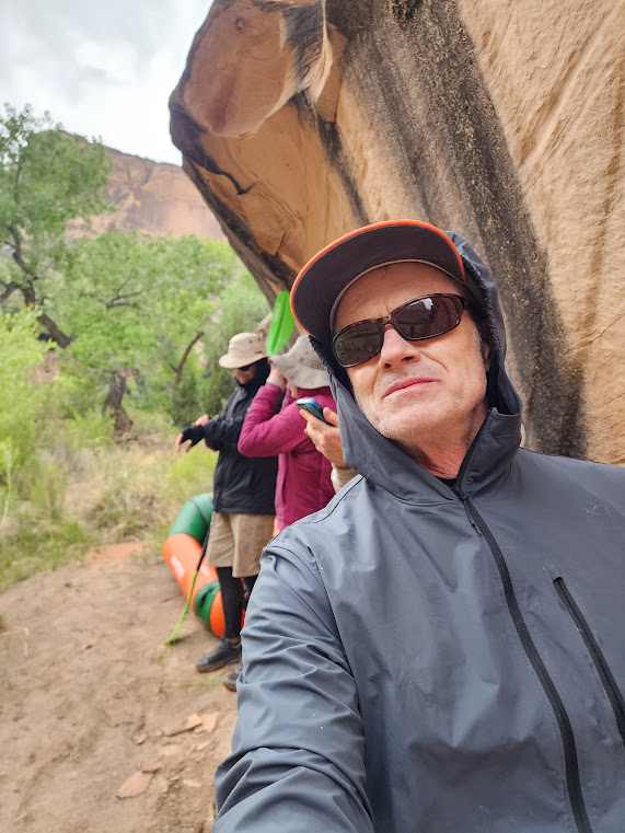
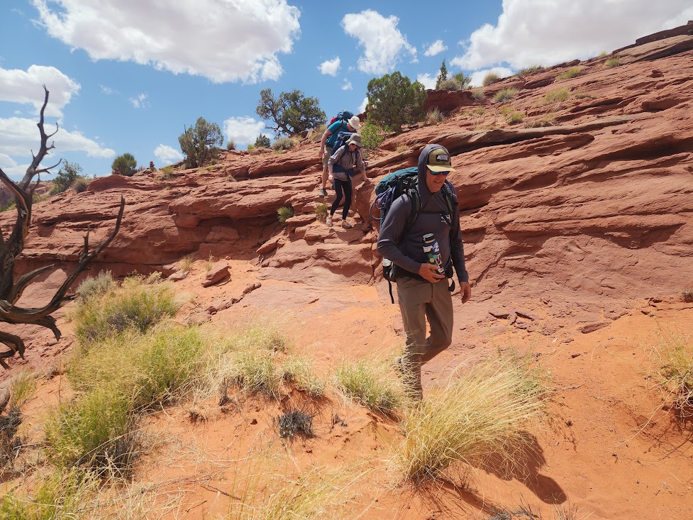
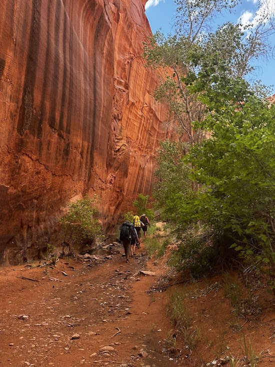
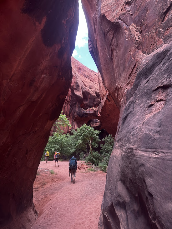
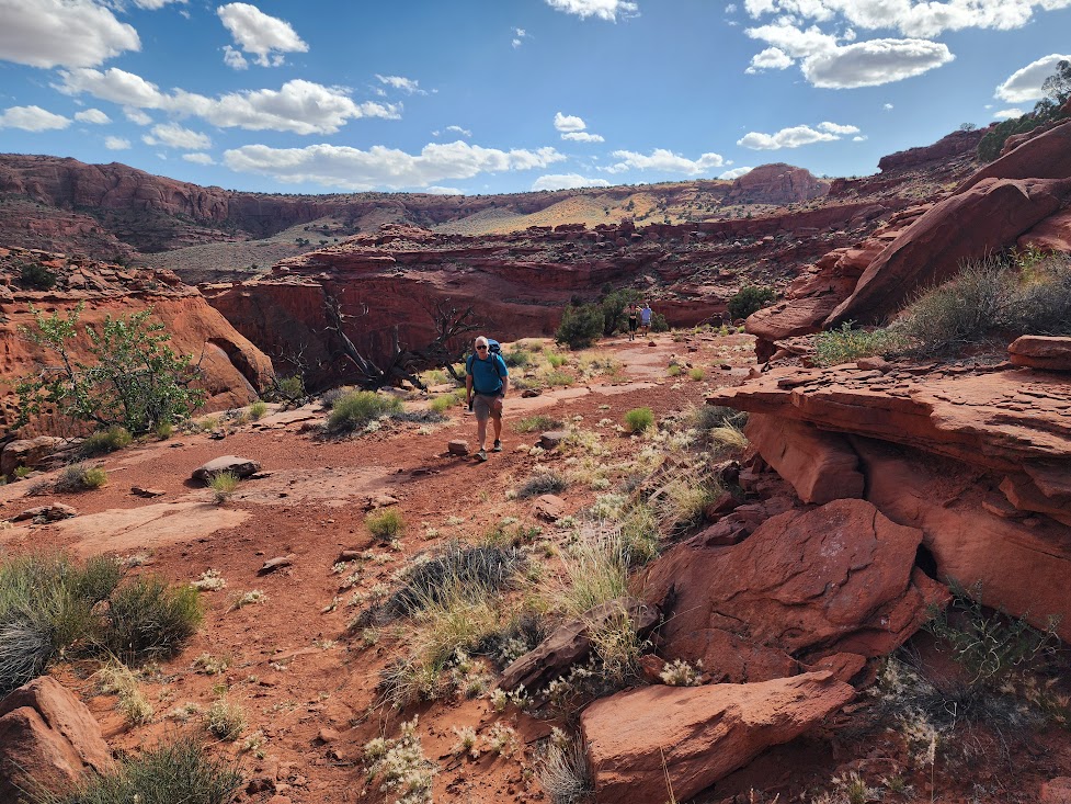
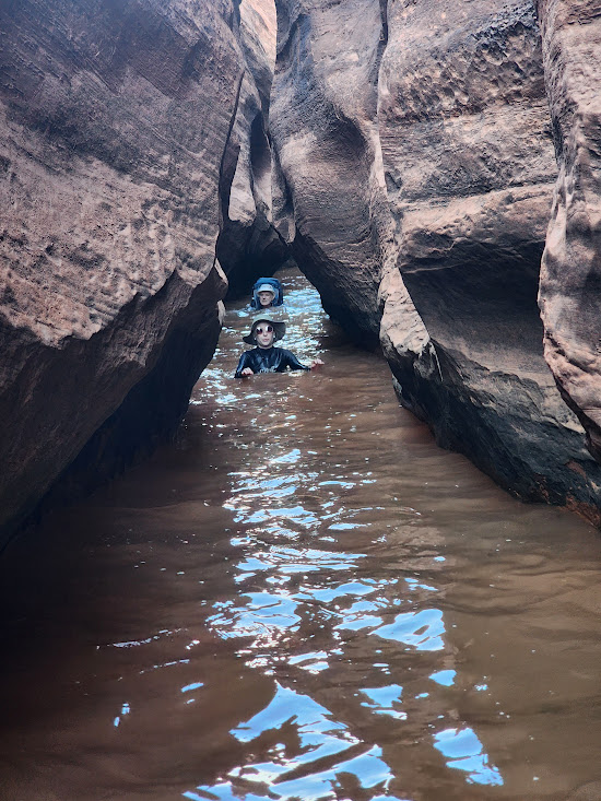
At 6:24 I received a message from Kerry that the Three Amigos (Kerry, Chris Hardwick, and Max Simmons) had reached the mouth of Fence Canyon and would pump water, repack, and start back to the trailhead. ETA 9-9:15. I drove out to the trailhead a bit early to cut down on the night driving.

There was a small group camped at the trailhead. They were going to be doing a multi-day trip much like the one the Amigos had done. They planned to take four days to do what the Amigos did in two. They were eagerly awaiting the return of the Three Amigos as they wanted to get intel about the canyons in question.
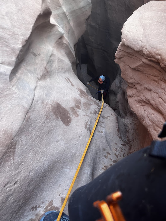
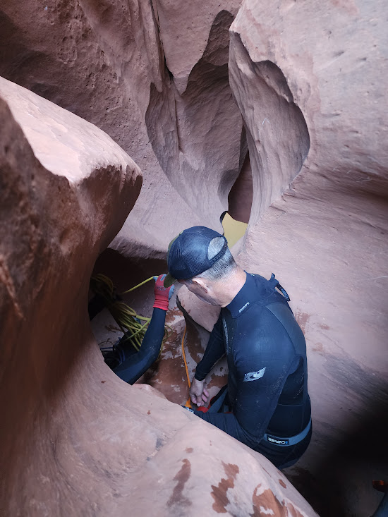
About 9:30 Kerry arrived at the trailhead and had a chat with the group camped there. Chris and Max arrived shortly after, and I was apprised of a development that was going to make an already long day even longer. Max had gotten his hand caught between a rope and a hard place and had sustained some substantial damage. It had bled substantially and he was in some pain. They had no first aid gear along, so he had just put on a glove that had managed to stanch the bleeding, and he wanted to have it examined by a doctor.
That was more than a bit of a problem. It was 10 pm on a Friday night, and we were in nowhere, Utah, 27 miles from the nearest paved road with no cell phone service. We loaded the gear into my car and I made the drive up Hole-in-the-Rock road until we got the Utah 12 where we could get some cell service. A search for 24 Hour ER’s turned up a number of options, with the closest one being 66 miles away in Panguitch.
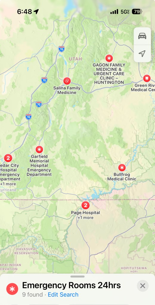
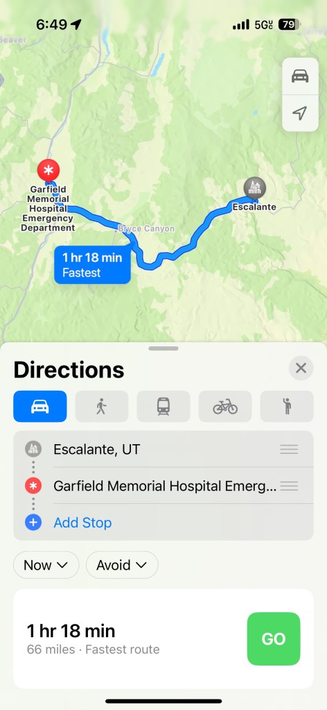
I hit the road and just before midnight we pulled up at the Emergency Room entrance at Garfield Memorial Hospital. Within seconds of our arrival an orderly appeared asking if we needed a wheelchair, and that was just the beginning of some top flight emergency medical care. Max walked in, found that he was the only patient, and was attended to by what seemed to be about 4 or 5 lovely nurses. I was a bit envious! While we sat in the waiting room a nurse came by and gave us cans of coconut water to tide us over. I can’t say enough nice things about the service we received at this hospital!
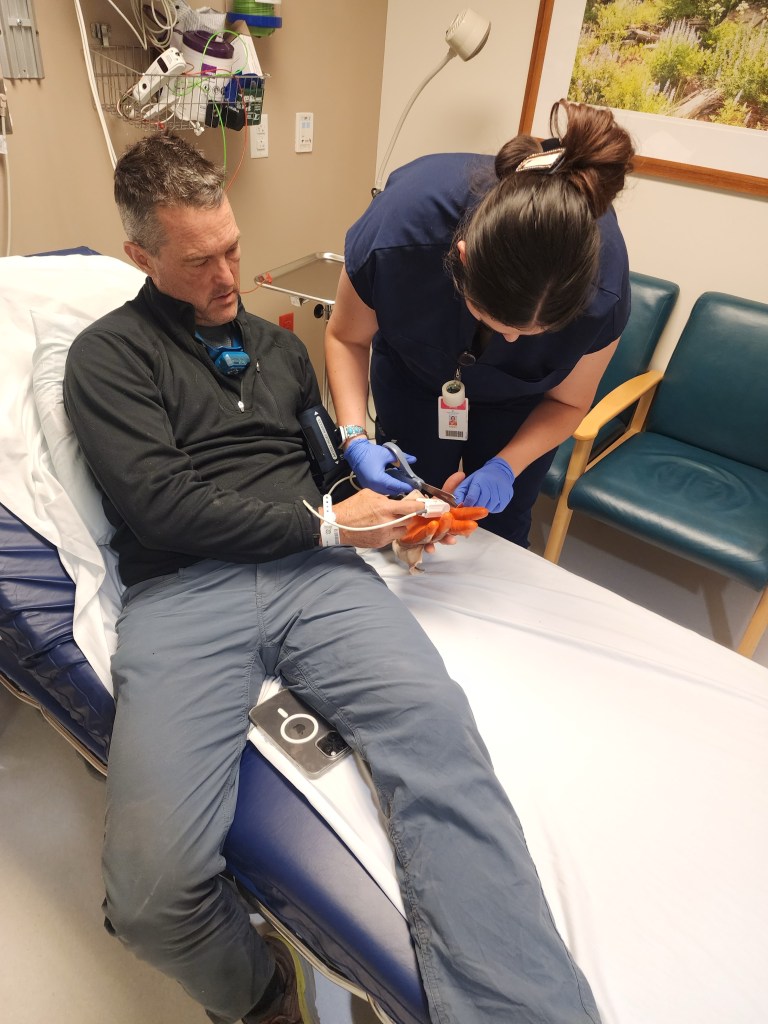
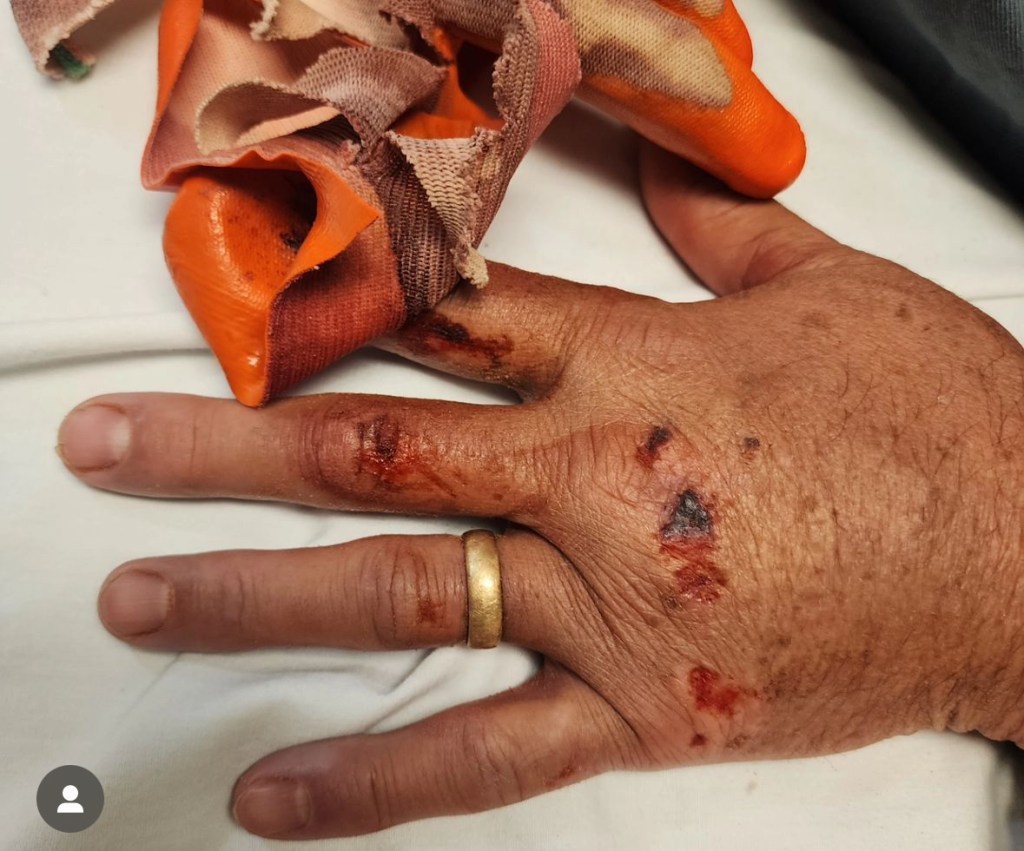
They cut the glove from Max’s hand, cleaned it up, took x-rays, and determined that nothing was broken and he didn’t even need stitches. We were free to go. The lads were pretty drained from their adventures over the past two days, and we were due to meet up with friends Sam and Audrey in the morning at the Swinging Bridge over the San Rafael river. That was 188 miles and over three hours away. A search for some lodging proved fruitless, so it was back to the road again.
The first phase of the trip was a 60 mile drive up US-89. Route 89 is a pretty awesome road that runs from the Mexican border up through Arizona, Utah, Idaho, and Montana to the Canadian border. I have driven quite a few miles on that road and have ambitions of driving the entire route, but I prefer to do it in that daytime! The ride was going smoothly, but as we approached Interstate 70 it began to rain.
By the time we got on the interstate the sprinkling had turned into a downpour. That segment of I-70 has pretty indistinct lane markings under the best of conditions, and under a heavy rainfall it was very difficult to see them, so the next 40+ miles were pretty nightmarish. I finally reached the point where I was at my limit and found a pull out where we could stop and I could close my eyes for 30 minutes. By that time the rain had stopped and the rest of the drive passed without incident.
Just before 5 am we arrived at the Swinging Bridge trailhead on the San Rafael River. Sam and Audrey had driven in the day before and had already headed down the river. Sam had left his truck at the trailhead with the keys in the exhaust, so Chris and Max moved over to the truck and the four of us settled in to try to get a couple of hours of sleep before hitting the river.
By about 8:30 we were up and moving around and trying to decide what to do next. Kerry Sherman had put in the day before about 20 miles upstream with a couple of friends. They were planning on a two day float terminating about 20 miles downstream, but we didn’t know how far they had gotten or if they were up or down stream from us. Sam and Audrey had put in at the Swinging Bridge about 7 pm the day before and were some unknown distance downstream. Water in the river was flowing quite nicely at just over 300 cfs.
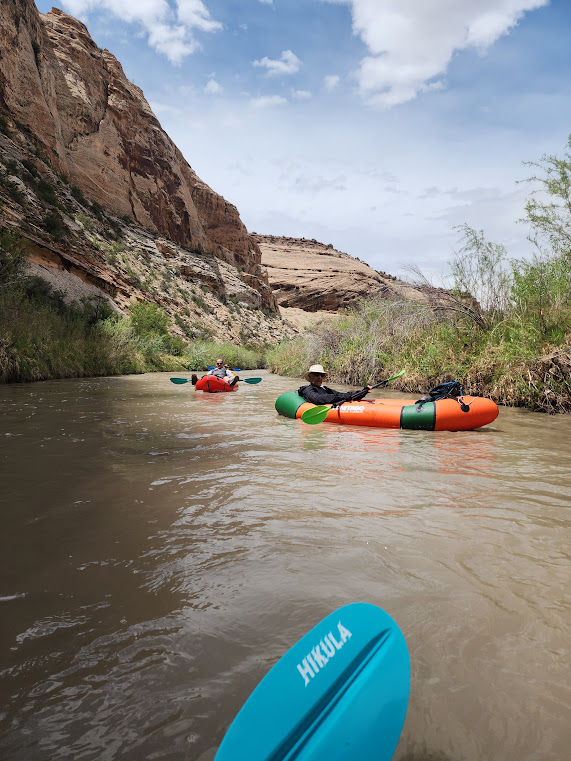
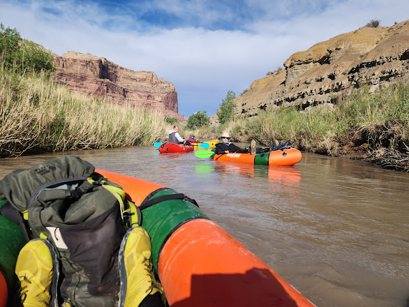
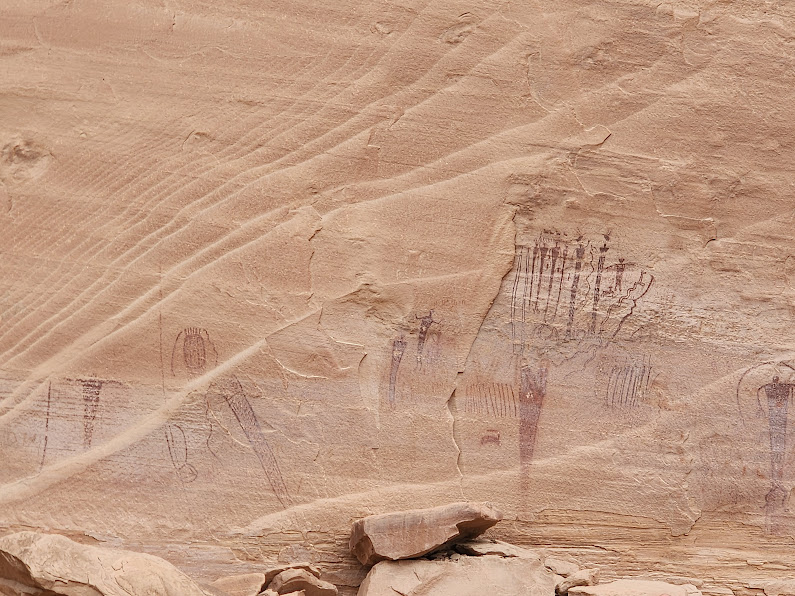
The segment above the Swinging Bridge passes through what is known as the Little Grand Canyon and is a serene flat water float that is very scenic. There are numerous opportunities to stop and explore side canyons rife with pictograms and petroglyphs. Below the Swinging Bridge the river has two segments, known as Black Boxes 1 and 2, where the canyon narrows and there are some extensive rapids ranging from Class II to Class IV.
About 9 we received a message from Sam that they had gotten downstream a few miles to just before the first Black Box where they had camped for the night. Sam had planned on running the two BB’s, but Audrey very sensibly had balked at rapids running without safety gear like life vests and helmets. They had come out of the river and were hitch hiking back to the Swinging Bridge with the plan to drive back up the river to Fuller Landing where they could put in and float the Little Grand Canyon. We resolved to do the same.


We did have a bit of a problem, however. My gas gauge said we had about 60 miles left, and the nearest gas station was in Green River, about 50 miles from where we were. My gas gauge tends to badly underestimate remaining miles, but trying to make the 20 mile drive to the new put in location and then get safely back to gas was not a prudent option, so our first task was to climb back in the car and make the drive to Green River to fuel up. The advantage was that we did get to see the stretch of road between the river and Green River in the daytime, and I got a chance to get some coffee.
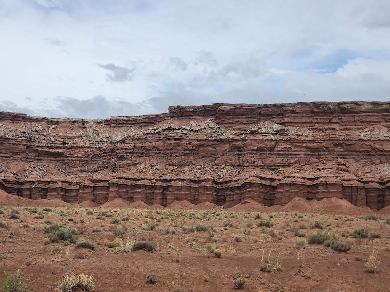
By 10:30 am we finally were back on the road. We crossed the river at the Swinging Bridge, and the next 10 or so miles took us through some pretty fantastic canyon lands in an area known as the San Rafael Swell. There were interesting rock formations and pictograms galore along the road.


Just before noon we reached the put in location at a location called Fuller Landing. We found Sam and Audrey as well as several other groups who were also entering the river at that point. There was even a drop in dog for our entertainment!
The lads then finally got to unpack their pack rafts, something that they had been looking forward to for a long time! The previous May I had supported Kerry Ward and Big Nate on a four day float down the Escalante. They had rented inflatable kayaks from REI for that trip, and the kayaks themselves were quite a load to carry. The video below shows Nate with his load, and for reference know that Nate is about 6’5″ tall. They were lucky there in that they got to drop straight into the river, but the exit four days later required a 2.5 mile hike with 1000 feet of elevation gain. Not easy with such a load!!
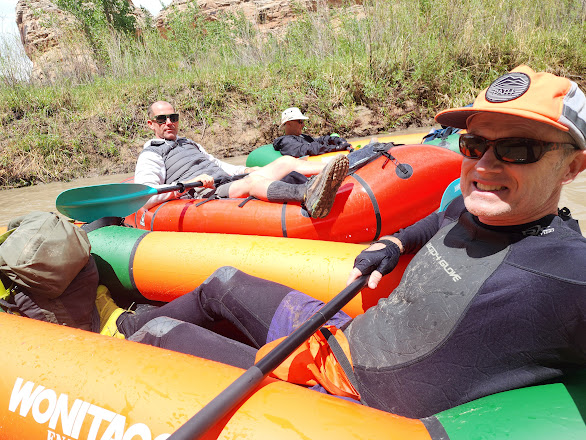
For this excursion they were using Pack Rafts, a kind of mini kayak more suitable to the kind of flat water rafting they were planning on doing. Sam and Audrey were using some more deluxe rafts that cost from 1 to 2 thousand dollars, but Kerry had found some considerably cheaper Chinese versions by Wonitago that are currently available for under $300 from Amazon. They pack down to a very small package that weighs just over 6 lbs!
The Wonitago rafts have an inflation process that doesn’t require a pump, making use of the carrying case as an inflation device. It does work but is more than a bit tedious, so for excursions like this one where it isn’t really necessary to carry the raft it would be advisable to have some kind of a pump.
Just before 1 pm the now Two Amigos (Max had decided to opt out of the rafting so as not to stress his hand anymore), plus Sam and Audrey, were ready to drop in and head down river.
Max had decided to opt out of the pack rafting, so the two of us were free to explore. Max is also a fan of coffee shops, so my plan was to do a scenic excursion. My plan was to first drive down to Hanksville where I had found a very nice little coffee shop named Mowgli’s that I had visited on an earlier excursion, but unfortunately it was closed. Instead we had some Mexican food at the Outlaw’s Roost, a local restaurant.
Hanksville sits in the shadows of the Henry Mountains, which were the last mountain range in the lower 48 states to be surveyed due to their very remote location. After our repast we drove down Utah 95, a very scenic route that starts in Hanksville, skirts the Henry Mountains to the east, and then winds through the canyons north of the Colorado River. The full route crosses the Colorado River at the Hite crossing and then continues through far southeastern corner of Utah until it terminates at US-191 south of Blanding.
We were working under a deadline as we needed to be back at the Swinging Bridge to retrieve Kerry and Chris, so we only got as far as the Hite Overlook. I took some pictures, but the wind was so strong that I feared being swept off the edge. I suffer from some vertigo, so even under the best of conditions I am not one to step right up to the edge, so I am falling back on the video I took when I traversed this route last August.
Then it was back in the car for the 120 mile drive back up to the Swinging Bridge. Our timing was perfect–we arrived just as the rest of the crew were extracting their rafts. There had been some thunderstorms in the interim and the river at that time was noticeably higher and faster than it had been in the morning.
It took less than an hour to deflate, repack the rafts, and reload the car. We were ready to head back to Saint George, but Sam knew of a hot spring that was almost on the way back. In addition to cats, Boba Tea, and high places, hot springs are one of those things that Seńor Ward does not pass up, so the next stage was a 2 hour drive to Monroe, UT, a small town south of Richfield for a quick soak in a natural hot tub.
Just before midnight we were back on the road. The drive along I-70, while only about 30 miles, seemed like forever, and by the time we hit I-15 it was apparent to me that my time behind the wheel had come to an end, so I relinquished the wheel to Kerry and closed my eyes. Thus ended a very long day! I will close with a slide show of images taken by Kerry and Chris on their 17 mile float down the San Rafael River. They did see a lot of other folks on this trip, and Kerry even picked up a hitchhiker for a short stint!